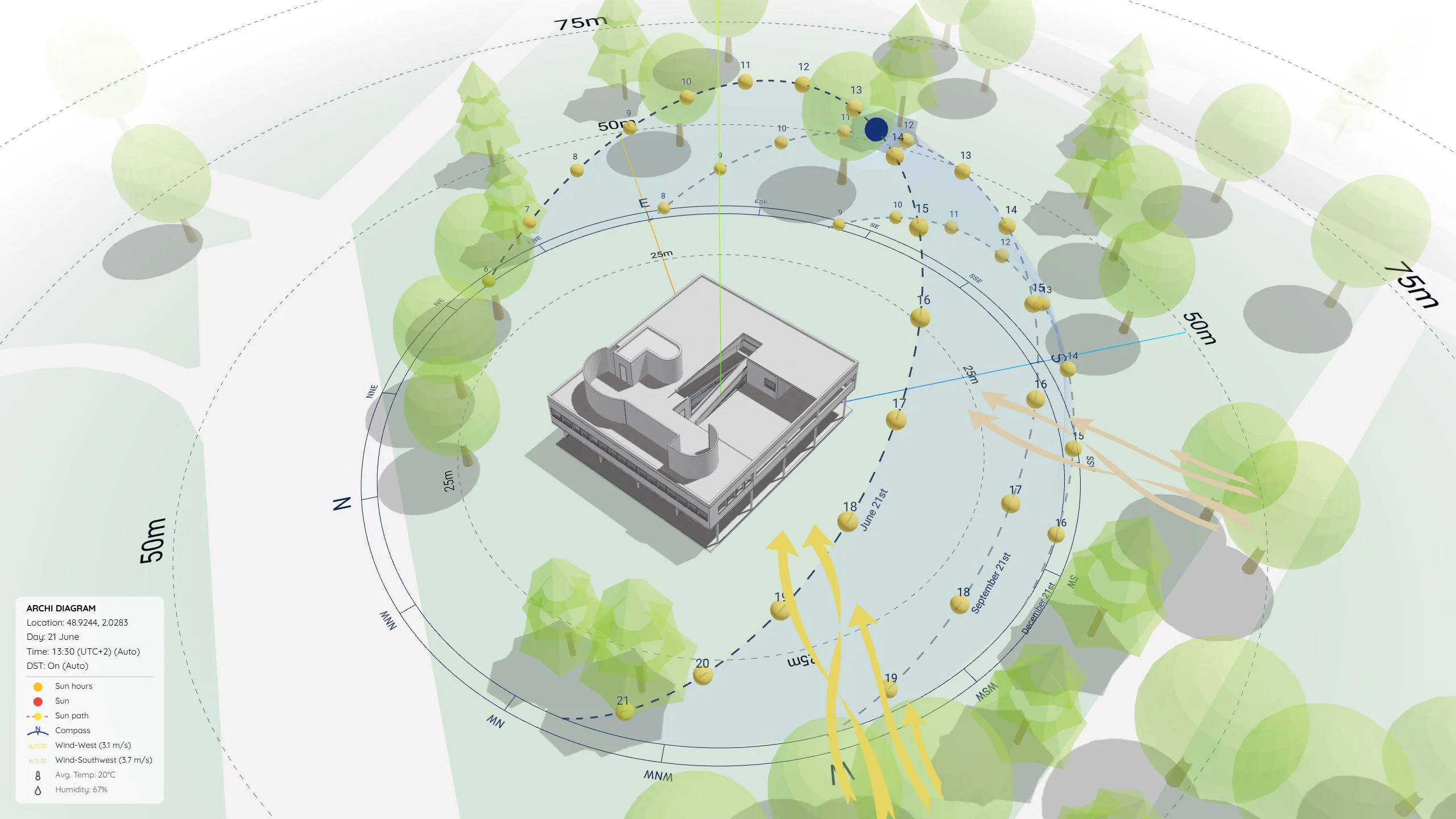
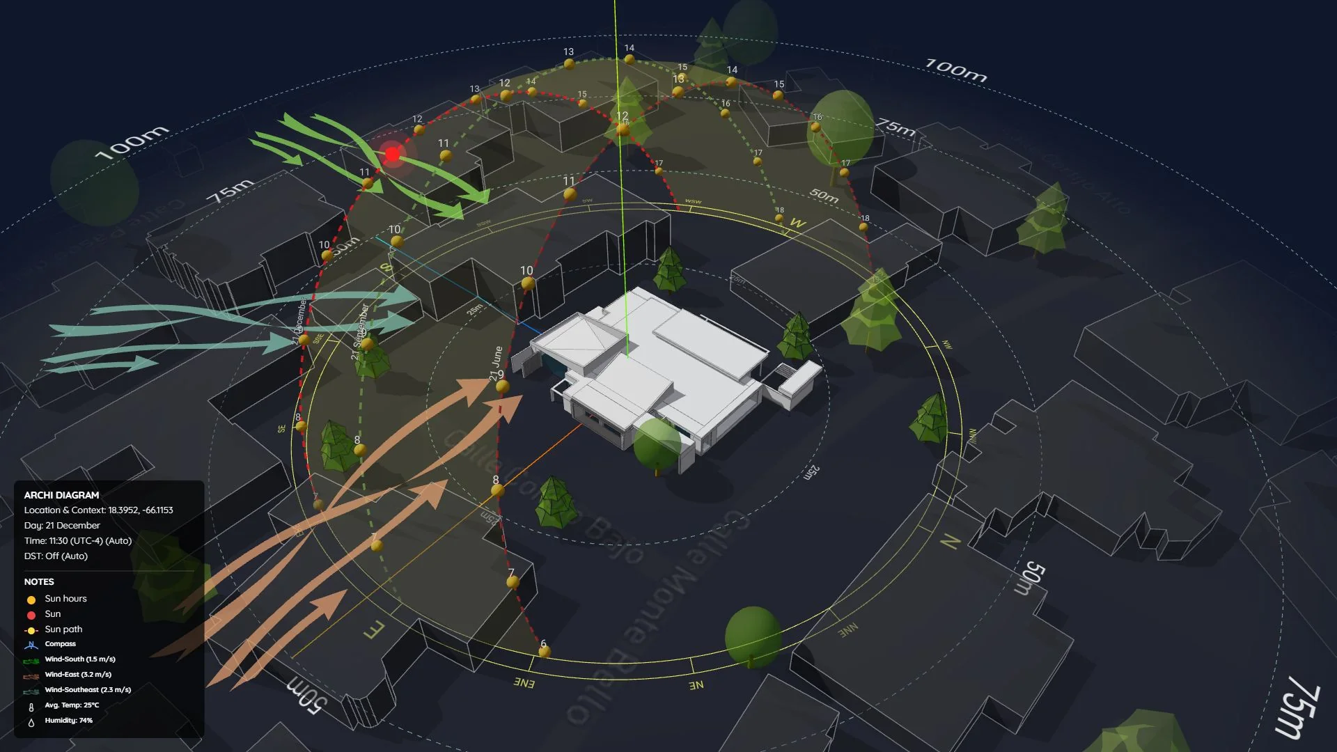
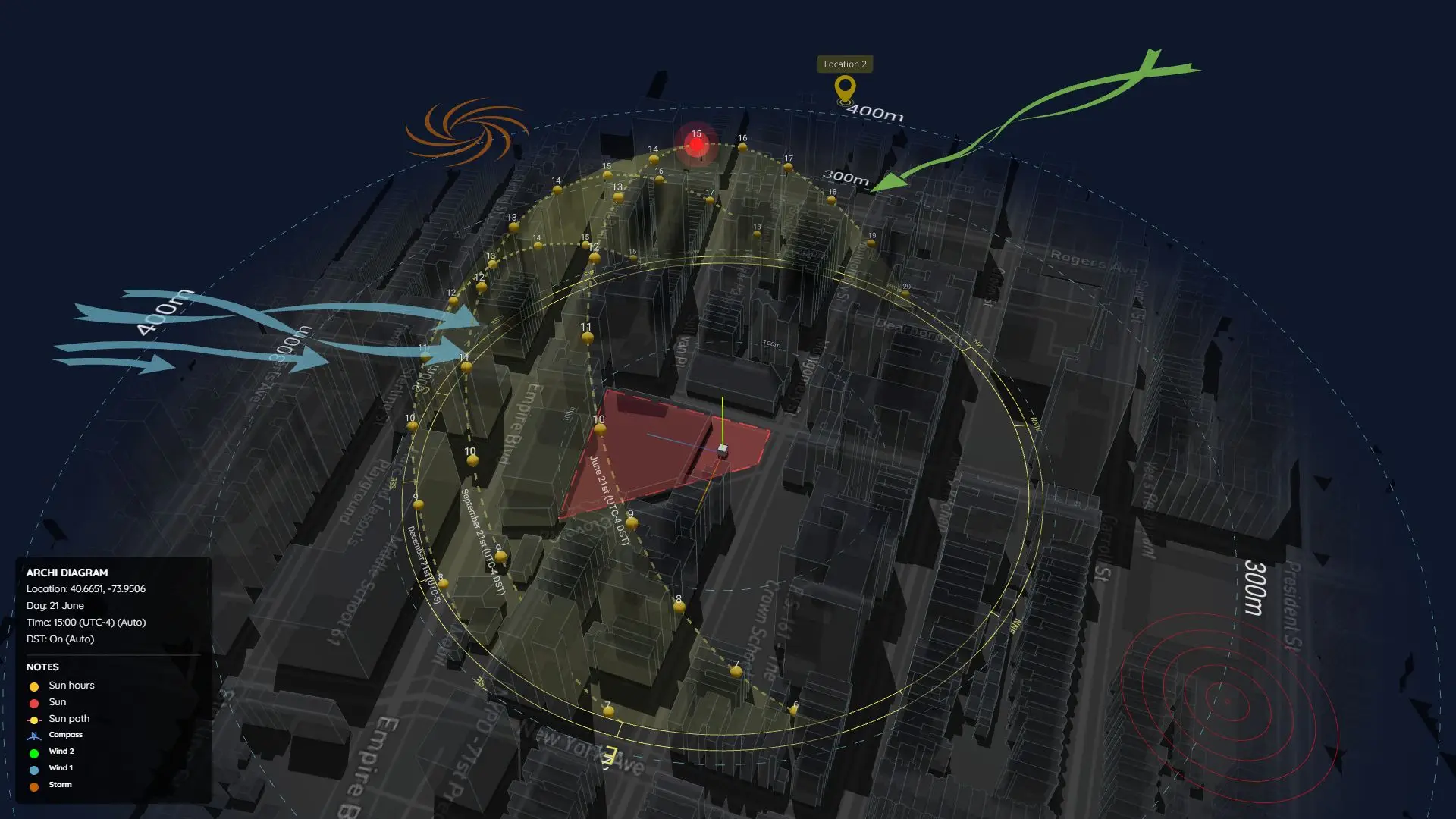
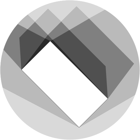
 ArchiDiagram Web App


Overview
Breaking the vertical tower into a breathable tropical village.
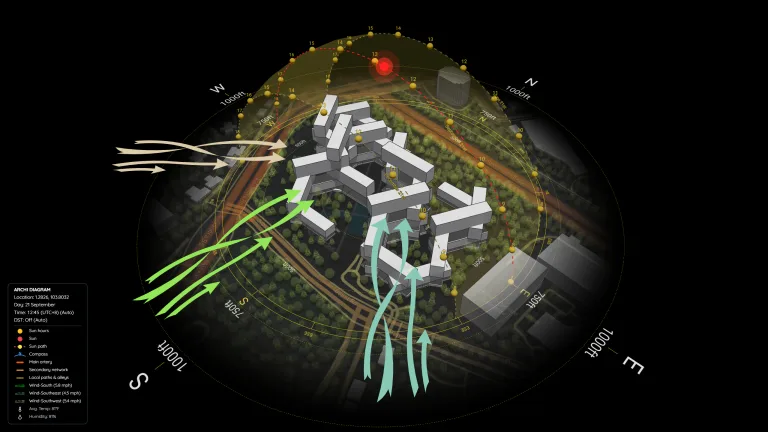
Thirty-one apartment blocks are stacked in a hexagonal grid to maximize airflow and self-shading under Singapore’s equatorial sun. The open gaps act as wind tunnels while stepped roof gardens reduce urban heat across the entire site.
Designed by OMA / Ole Scheeren in Singapore (1.2826° N, 103.8032° E), The Interlace reimagines high-density tropical housing by interlocking 31 six-story residential volumes around eight permeable hexagonal courtyards. Using this interactive ArchiDiagram App sample file, you can study how the stacked geometry responds to equatorial sun angles, seasonal monsoon wind shifts, surrounding road networks, and the lush Southern Ridges green belt.
How It’s Made
Watch the screen recording below to see just how remarkably simple it is to build this entire The Interlace climate and site analysis from scratch in the ArchiDiagram App with zero manual 3D modeling:
https://www.youtube.com/watch?v=i5GU00ukd5o
- 1. Enter Coordinates & Auto-Generate Everything (
1.2826, 103.8032): Simply paste the site coordinates into Location Search and confirm. The software automatically fetches and displays all site and climate data, including the entire 3D stacked hexagonal building massing, surrounding road hierarchy (Ayer Rajah Expy, Alexandra Rd, Depot Rd), urban tree canopy, courtyard water bodies, the equatorial 3D Sun Path (UTC+8,DST: Off), real-time shadows, and NASA seasonal wind flows. - 2. Fine-Tune Manually or Apply 1-Click Built-In Styles: In the video above, I make a few small manual adjustments to colors, map opacity, and scale to dial in a custom presentation look. Prefer an even faster workflow? You can skip manual tweaking altogether and simply click any ready-made preset inside Diagram Styles (Default Dark, Clean Light, Monochrome, and more) for instant polished graphics.
- 3. Export 3D Views, Video, or 3K A3 Presentation Boards: Scrub across dates and hours to study courtyard self-shading and wind-tunnel gaps, then export high-resolution 3D stills, smooth MP4 animations, or print-ready A3 Landscape sheets in one click via Smart Export.
3D Solar & Wind Perspectives (Dark & Light Styles)
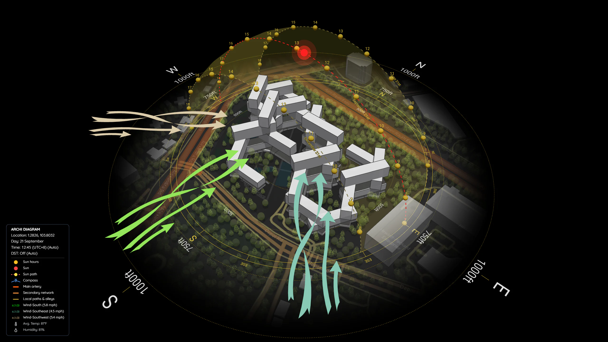
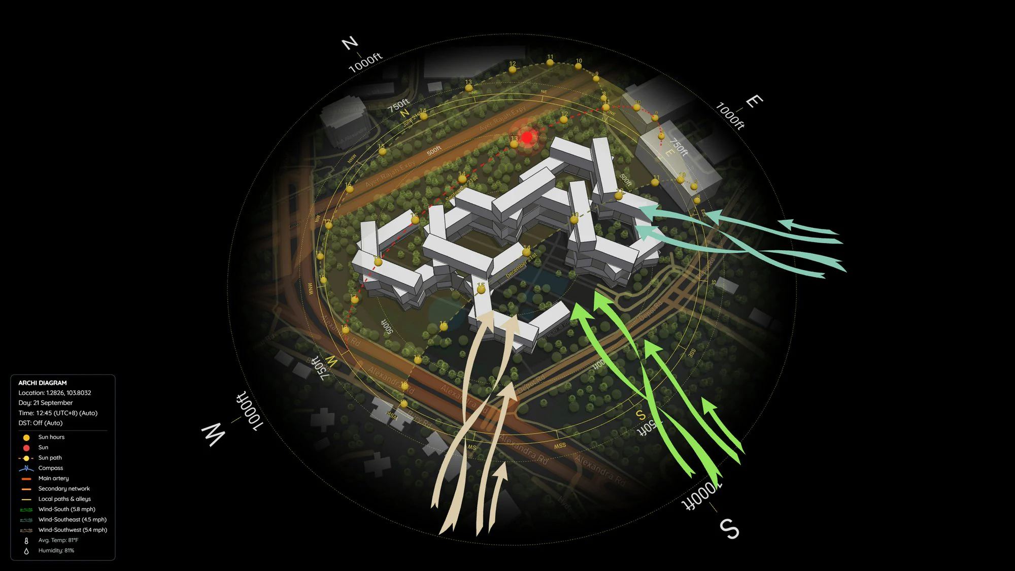
Below are 3D perspective views exported directly from the sample project on the September Equinox (21 September), comparing Default Dark and Clean Light styles across midday (12:45) and afternoon (14:30) solar positions:
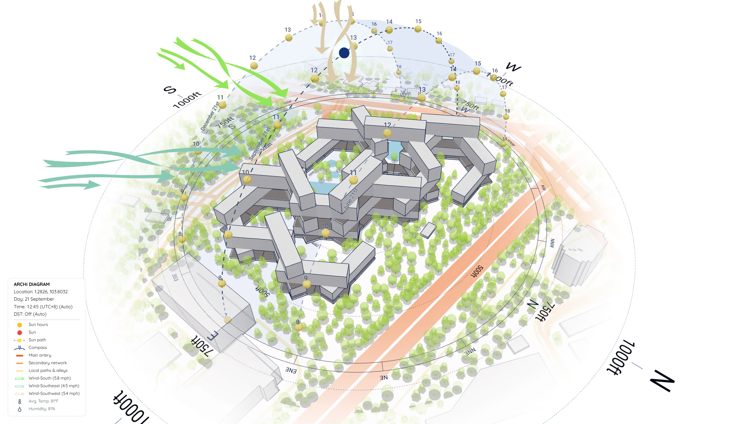
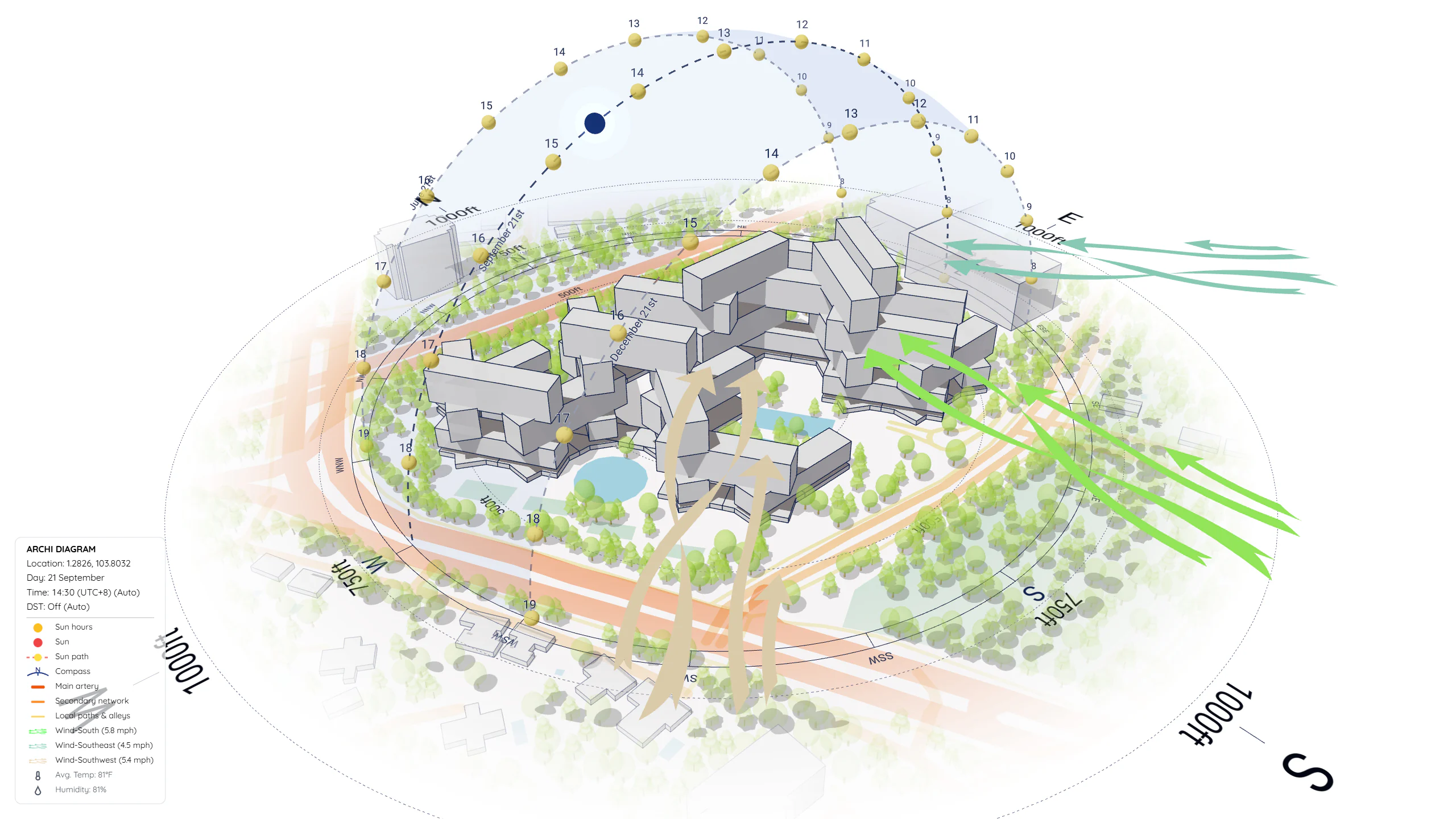
Automated A3 Presentation Boards (3K Smart Export)
Using Smart Export in the ArchiDiagram App, the same live 3D model generates complete A3 Landscape (3K) analytical sheets ready for studio pin-ups, competition boards, or Canva/InDesign layouts:
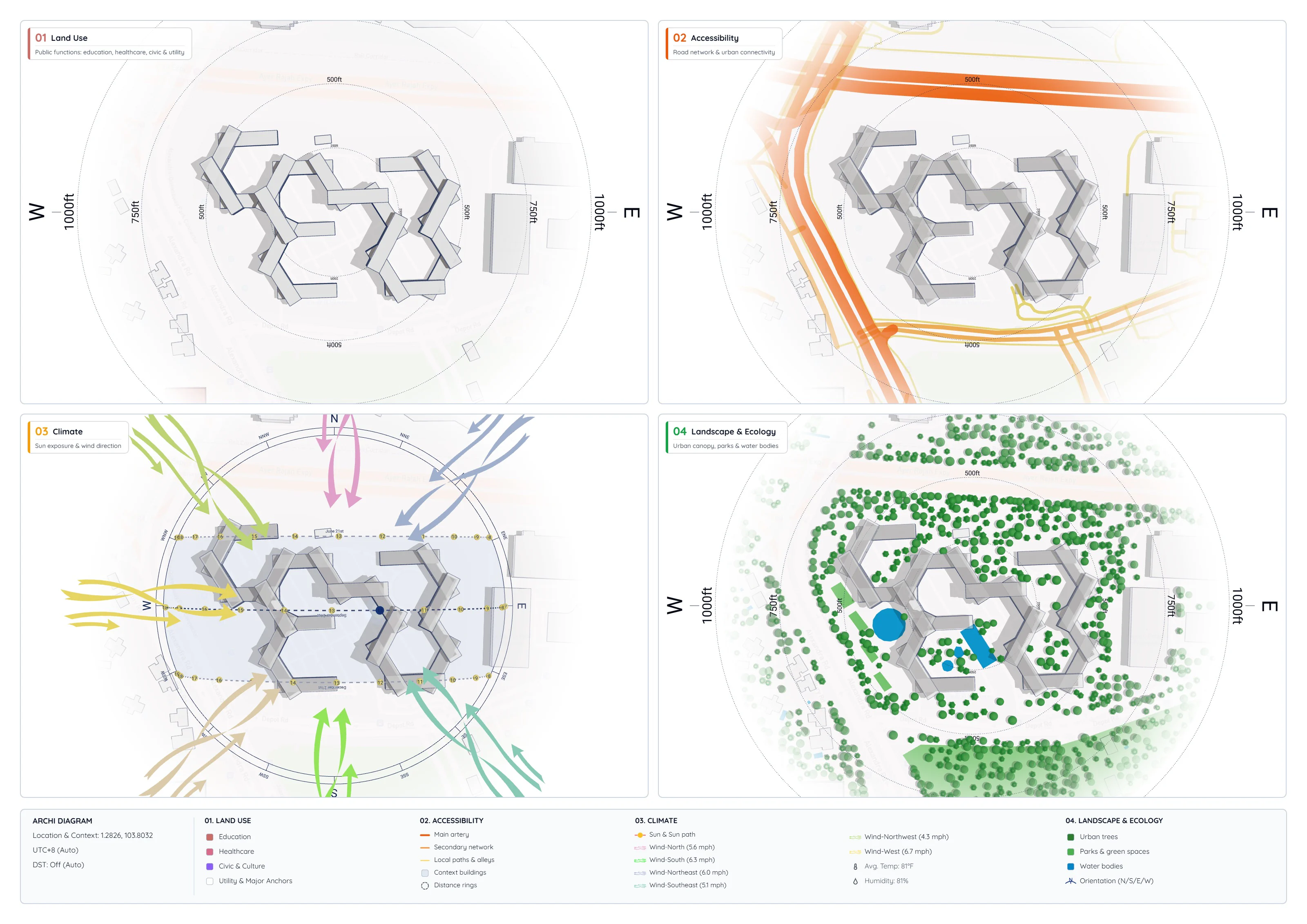
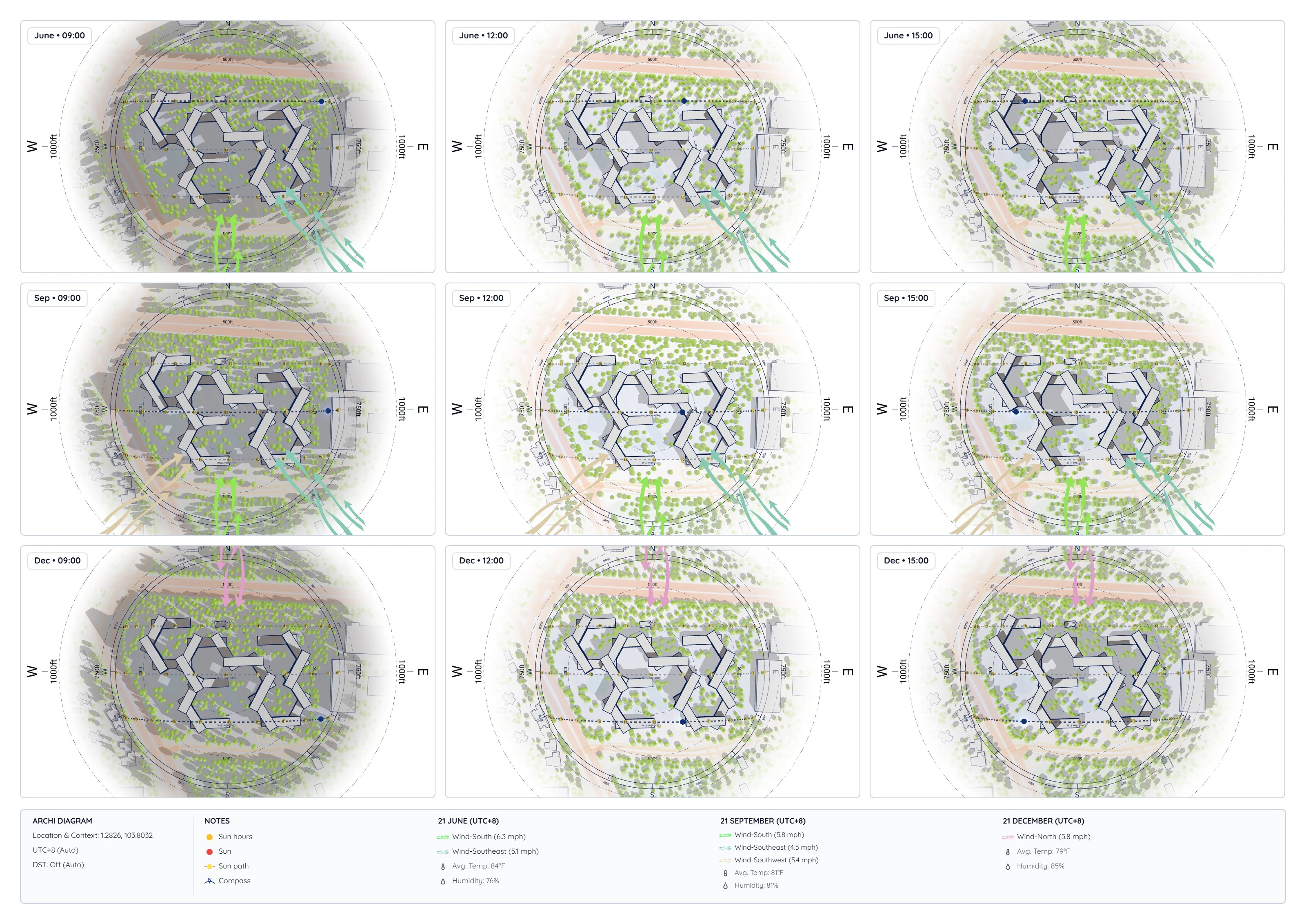
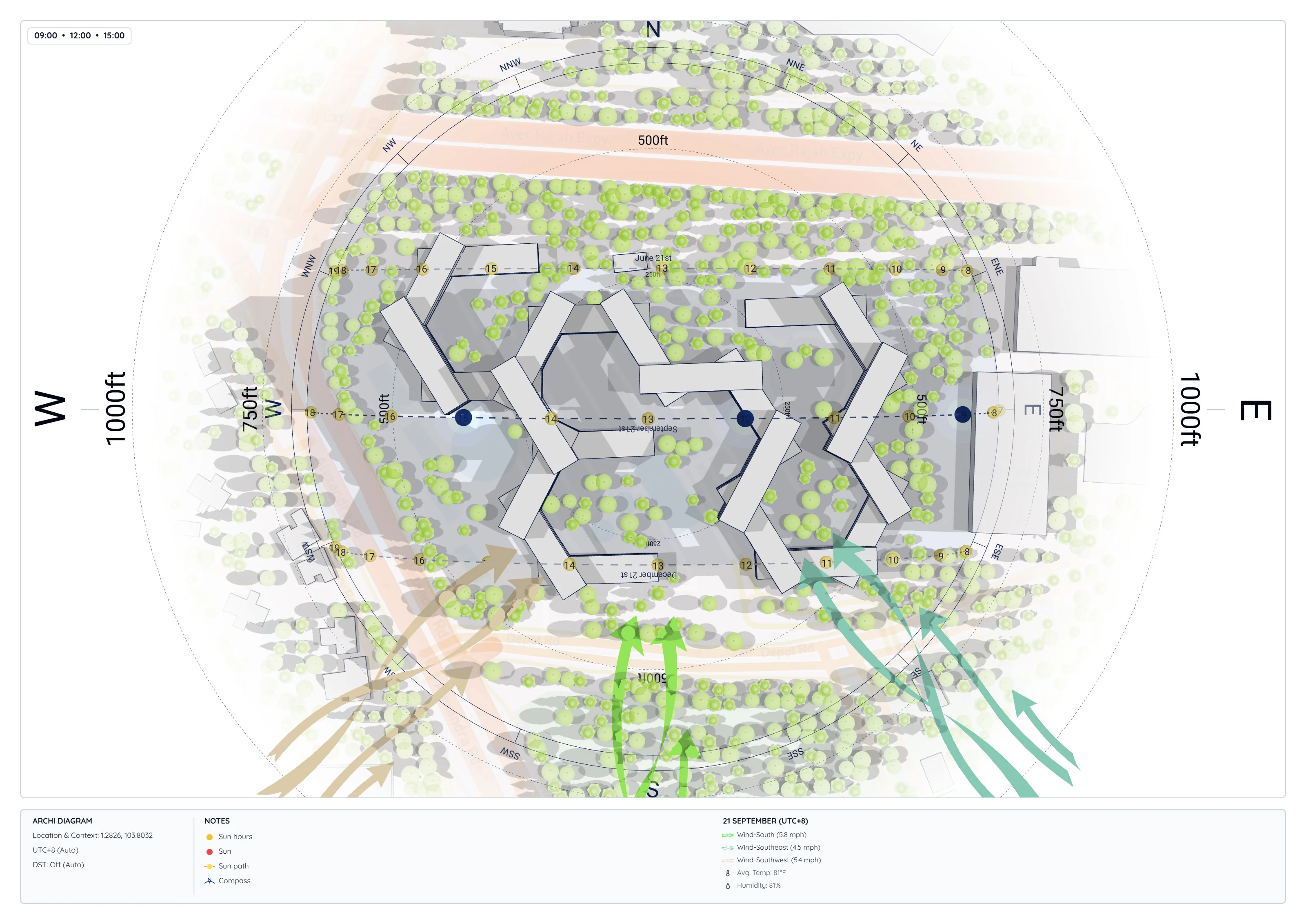
Open Project: You can explore this exact project in your browser. Orbit around the hexagonal courtyards, test different solar dates, or export custom presentation boards and modify it yourself.