Daylight Saving Time (DST): Why Standard 3D Software Fails at Global Solar Analysis
Most current 3D design software shares a significant blind spot when it comes to environmental analysis: they fail to comprehend the dynamic nature of real-world time.


The root of this issue is DST (Daylight Saving Time). This is a real-world convention where clocks are set forward by one hour during the summer months, observed by many countries worldwide. When architects work on global projects using standard 3D tools, they typically lock in a static time zone (UTC) for the entire project. As a result, their shadow simulations become completely misaligned with actual local time for half of the year.
Let’s examine this simulation error across two different hemispheres:


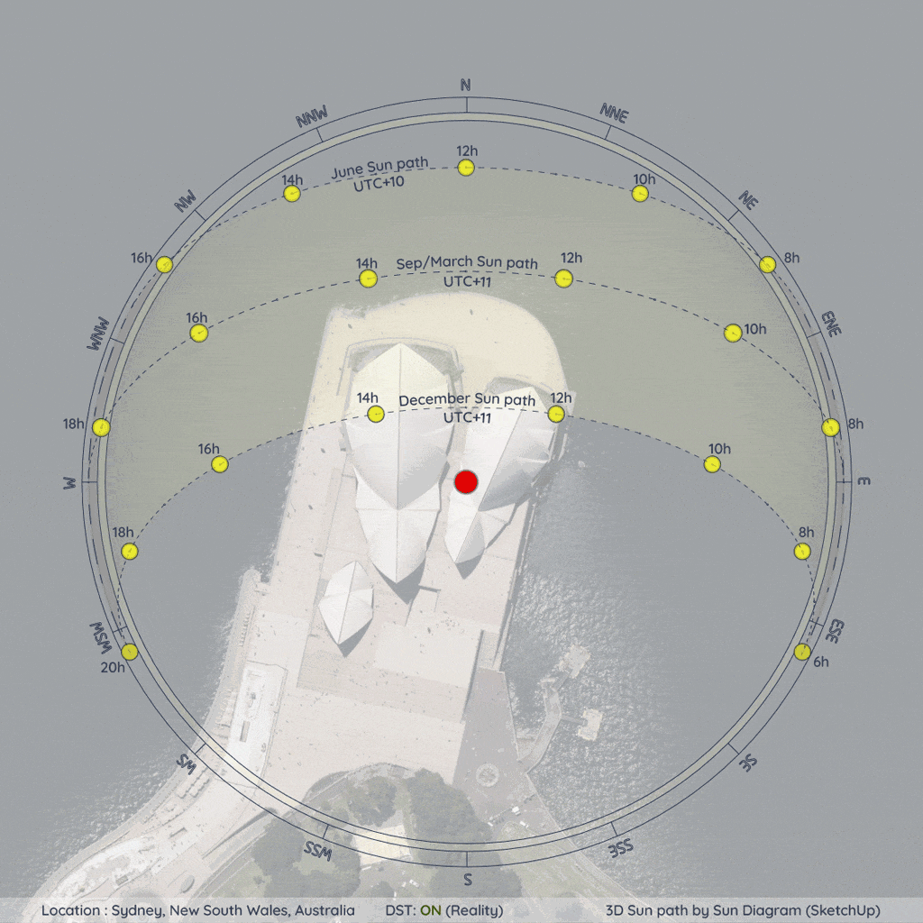
Case Study 1: Sydney, Australia (Southern Hemisphere)
Figure 1: Visualizing the DST impact in Sydney. When fixed to standard time (UTC+10), the December summer simulation is misaligned with actual local time.
In Sydney, summer occurs in December. During this period, DST is active, making the actual real-world time zone UTC+11. If a designer locks the environment to standard time (UTC+10) year-round, the sun's position and the resulting shadows at any given hour in December will lag exactly one hour behind reality


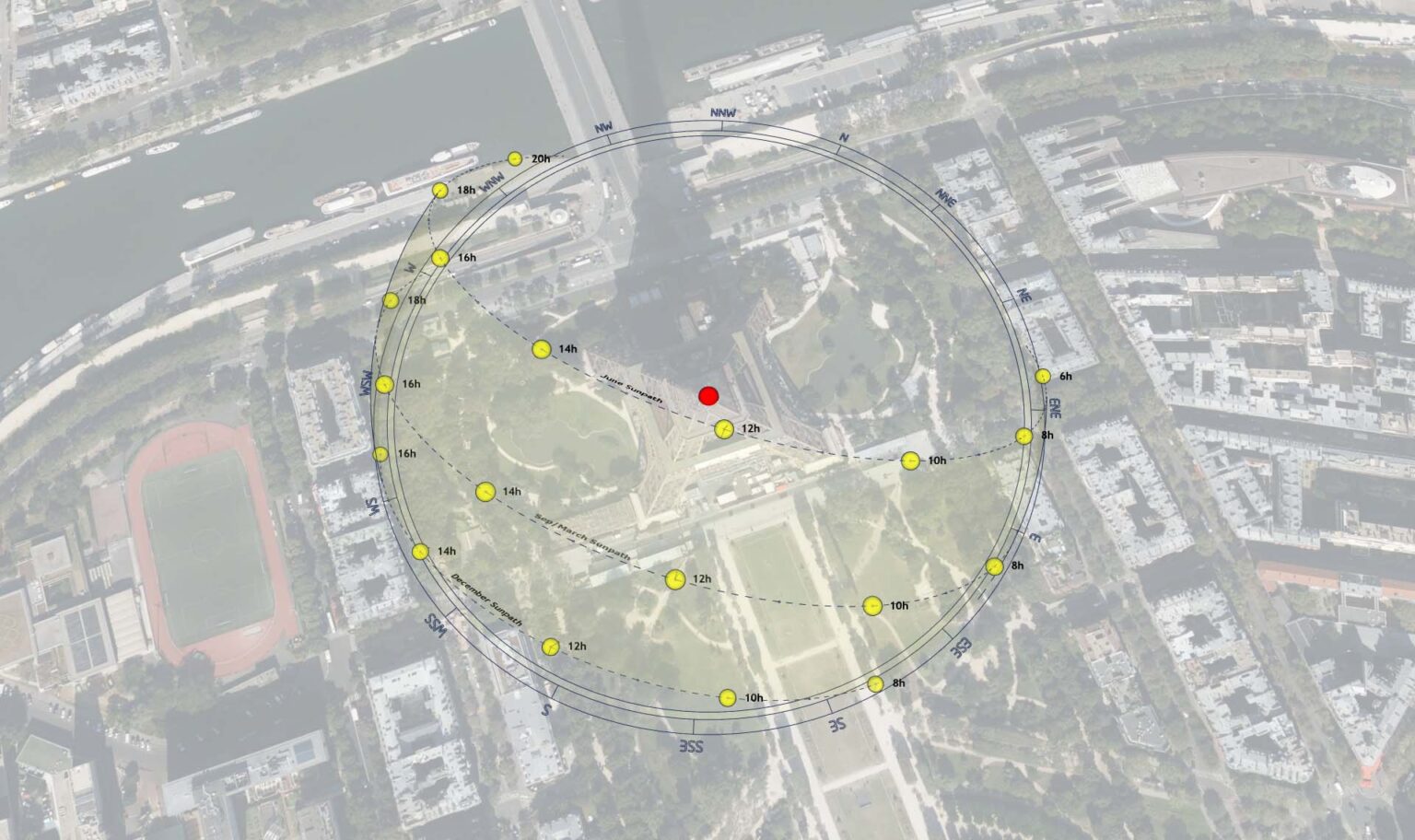
Case Study 2: Paris, France (Northern Hemisphere)
Figure 2: In Paris, the summer sun path (June) requires a shift to UTC+2. Without it, the entire lighting analysis for the warmest months is compromised.
Conversely, in the Northern Hemisphere, summer falls in June. Paris operates on standard time (UTC+1) in the winter but shifts to UTC+2 during the summer months. Forgetting to manually adjust this offset when rendering a June solar study means presenting false daylight data to clients.
Bridging the Gap Between Software and Reality
To overcome these architectural blind spots, the next generation of environmental analysis tools must move beyond static UTC inputs and integrate dynamic time-zone algorithms.
For instance, tools equipped with a Smart Time Zone Engine—such as the Sun Diagram extension for SketchUp—demonstrate how this real-world complexity can be seamlessly automated. By analyzing a project’s latitude, these advanced systems can algorithmically determine the hemisphere and automatically apply the correct seasonal offset.
Instead of relying on manual, error-prone adjustments, this approach ensures that the UTC offset is dynamically corrected as the designer navigates between different months. Ultimately, embracing automated time-adjustment workflows allows architects and urban planners to deliver site analyses that withstand the strictest scrutiny, ensuring that design intent perfectly aligns with real-world conditions.
(Note: For professionals looking to automate this aspect of their workflow, the Sun Diagram extension provides a built-in solution. Learn more at SunDiagram.com)
About the Author
Nam Nguyen
Architect & Software Developer | Founder of Febhouse & ArchiDiagram
I build tools like Sun Diagram, Dynamic Symbols, and Shadow Slice to help architects work smarter.


